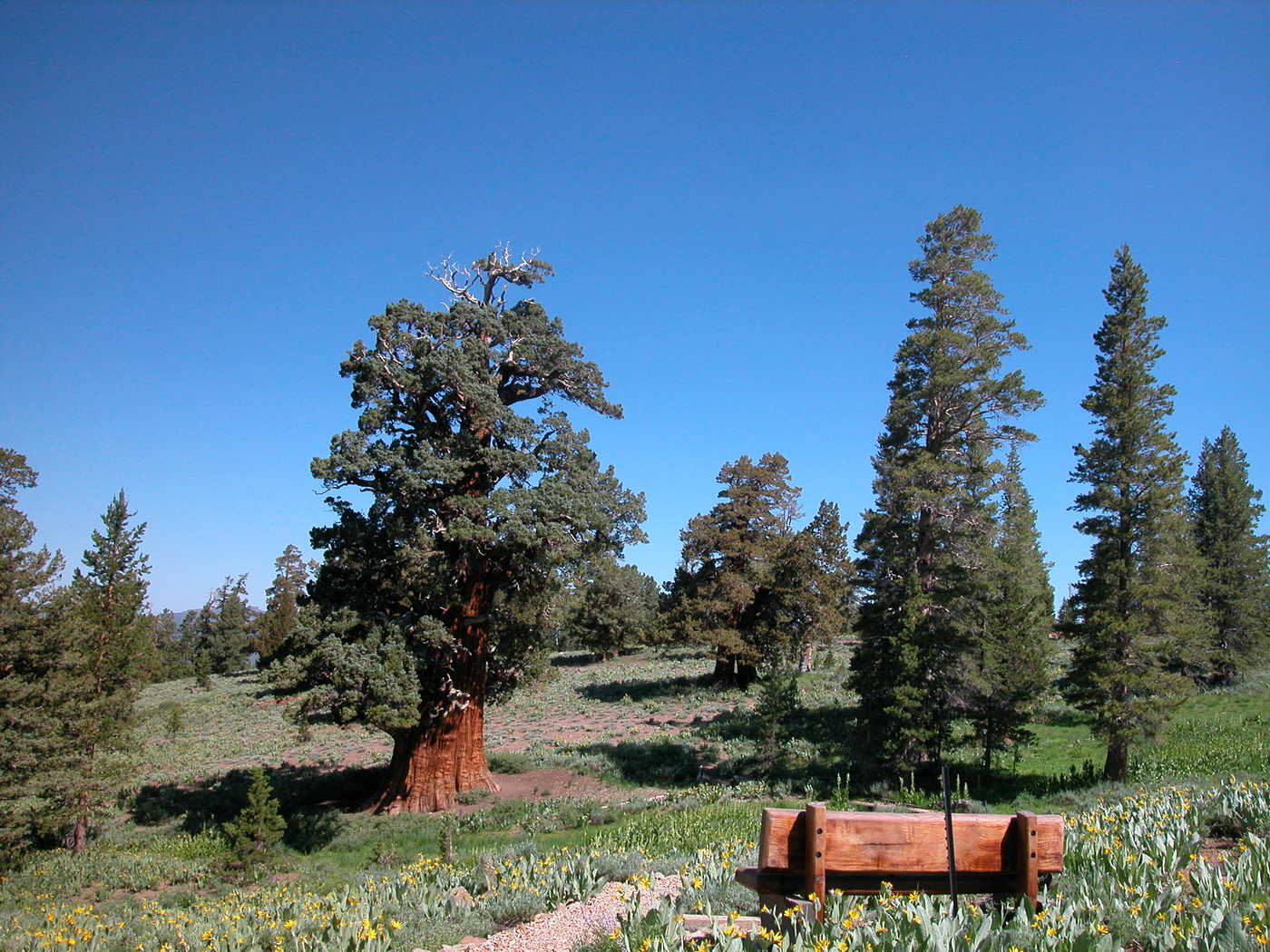
In November 2022, the League donated the Bennett Juniper property to Mother Lode Land Trust (MLLT), which will be the permanent steward of this land and its ancient juniper tree. The League also secured $40,000 in seed funding for MLLT’s long-term stewardship.

History
The extraordinary Bennett Juniper tree was under Save the Redwoods’ protection in California’s Stanislaus National Forest because The Nature Conservancy conveyed it and the surrounding buffering land to us in 1987. Before then, rancher JW Martin Sr. protected the tree until donating it and the surrounding 3 acres in 1978 to The Nature Conservancy.
The tree is named after naturalist Clarence Bennett, who began his study of the western juniper (Juniperus occidentalis) in the early 1890s. Then, the tree was still referred to as a shrub. Juniper “shrubs” reached heights of 50 to 70 feet and core samplings showed many to be at least 3,000 years old. Bennett made field observations of the western juniper from Oregon to Mexico, collecting fallen branches as he went. When he returned from the field, he counted the core rings and made meticulous measurements to ascertain ages and growth rates of the trees.
In 1932, longtime Tuolumne county rancher, Ed Burgeson, led Bennett to this location and showed Bennett a large western juniper that Basque sheepherders had discovered in the 1920s. The gnarled and weather-worn tree is more than 80 feet tall.
The Bennett Juniper and others of its species face freezing temperatures, strong winds, poor soil and low moisture, and still they persist and grow high in the Sierra Nevada.
PRESS RELEASE
- October 25, 2022 — Save the Redwoods League Donates One of the Oldest Trees in the World, Bennett Juniper, to Mother Lode Land Trust
When to Visit
The juniper is at 8,400 feet elevation, so the summer access season is controlled by snow melting off the roads. On the average, the road is open by mid-June and usually stays open through October. There are two significant creek crossings (Eagle and Long Valley) that might be beyond the capabilities of the average street car early in the summer. Normally by August, any vehicle can make it in by driving slowly and carefully. It is definitely easier with more ground clearance. Check with the Forest Service Summit Ranger Station for current road conditions: (209) 965-3434.
How You Can Help
- Please refrain from climbing on the tree and its roots.
- Hunting, camping, fires, wood gathering and snowmobiling are prohibited on the preserve.
Directions
The Bennett Juniper is in Tuolumne County in the Stanislaus National Forest in California’s Sierra Nevada. Access to the juniper is via backroads off of Highway 108. The turnoff from Highway 108 is about an hour and a quarter east of the town of Sonora and is about half way between the communities of Strawberry and Dardanelle Resort (13 miles east of Strawberry). Consider topping off your gas tank before leaving civilization.
The turnoff from the highway is marked by green CalTrans signs for Eagle Meadow. The Forest Service also has a sign for Niagara and Niagara OHV campgrounds.
While the juniper is only about a dozen miles off the highway by road, it is still an hour’s drive. Enjoy the views on the journey and do not be in a hurry.
From Highway 108
You will be following Forest Service Road 5N01 most of the way in. The road is informally known as the Eagle Meadow Road, though it goes far beyond Eagle Meadow. It is the main road. When in doubt, continue straight. There are numerous unmentioned road spurs along the way. Do not expect any road signs for the juniper.
Mileage Log from Highway 108
- 0.0 — Start. Just off the highway is a large parking area. Useful for assembling a group or arranging carpools. Do not leave cars here overnight.
- 0.3 — Turn right.
- 1.0 — Cross the first cattle guard and stay right.
- 3.0 — Cross the bridge over Niagara Creek. Go past the OHV campground. In 100 yards the road forks. Stay right.
- 5.5 — At the end of the pavement continue straight about a quarter mile until you reach an intersection with the right fork being paved. Take the pavement up the hill to the right.
- 6.3 — Pavement ends again at the pass. Cross the pass and veer right and downhill.
- 7.4 — Cross Eagle Creek. (Eagle Meadow is out of sight behind the willows on your right).
- 8.7 — Cross Long Valley Creek and continue straight up the grade.
- 9.4 — You are at a “T” intersection. Go left.
- 9.9 — Cross the third cattle guard and stay right and up the hill.
- 10.4 — The road hooks to the left crossing a small seasonal stream.
- 10.6 — Stay straight and uphill.
- 11.0 — Starting a long switchback up a through a sagebrush and mule ears meadow.
- 11.9 — Continue straight. You are now on top of a flat open plateau. Once you are past the small pond below the road and back into the trees start looking for a side road on your left. If you reach the fourth cattle guard, you missed this side road by a couple of hundred yards.
- 12.4 — This is the turnoff for the Bennett juniper. Road 5N83Y. Downhill and to your left.
- 12.5 — Take left fork (technically Road 5N83YB).
- 12.7 — You made it! Congratulations and welcome.
GPS folks and topo map readers: The Bennett juniper is at N 38 degrees 18.547 minutes by W 119 degrees 47.826 minutes. Skilled topographic map readers will find the juniper at Range 5 North, Township 20 East, center of Section 5. View and download the Bennett juniper topo map.
Google map and directions to Bennett juniper from San Francisco. (external link)