OK, where’s the corral?

Photographer Dave Van De Mark searches for a spot he photographed more than half a century ago in Redwood National Park

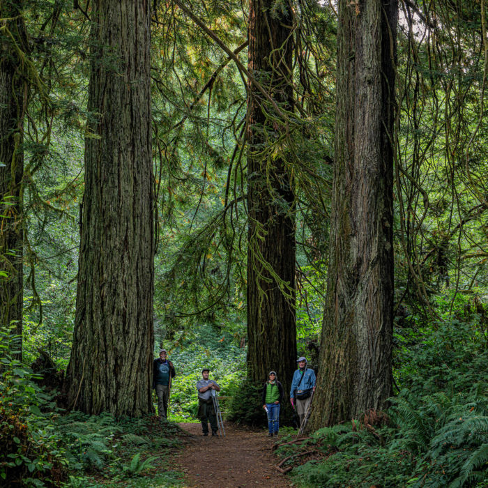
Fifty-three years to the day(!), five of us headed out on the lower Redwood Creek Trail in search of the location of a corral, easily visible in a photo I took on August 27, 1967. It has been on my mind for several years now because it would help me tie down exactly where I was standing when taking the photo.

Black-and-white photo of seven backpackers hiking on a flat, open trail surrounded by conifer forests on a mountain.
Photo by Dave Van de Mark, taken in 1967.

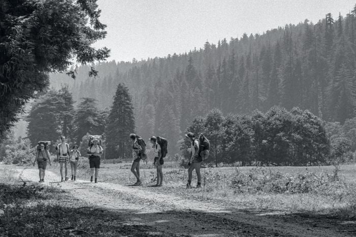
A tight cluster of three young trees can be seen rising up in the distance and just behind some fencing that was part of a corral. Also, a small “grove” of redwoods, with one tree very flat topped, can be seen behind the four left-most backpackers. I am still trying to document where all of us had been but that is not part of the corral story.

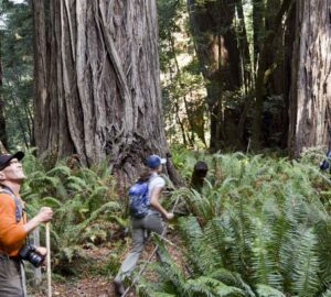
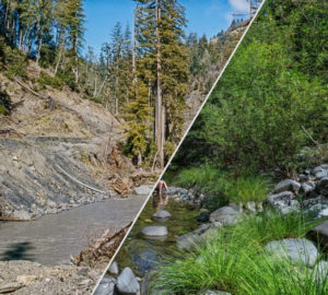
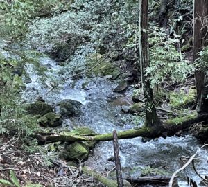
In this area of Redwood Creek, there were homestead buildings and cattle grazing, at least up to the 1964 December storm. In 1967, the road the backpackers are on was being used by Arcata Redwood (and possibly Georgia-Pacific) to move out logs. I never got much help in my initial efforts to locate where the corral was. But on a hike I took mid-August 2020, I stumbled upon a view of three trees that struck me as very similar to the trees I saw in 1967. The response from others was basically, “Naaawwww!”

A trail through a forest of redwoods and hardwoods.
Photo by Dave Van de Mark
“They haven’t grown enough.”
“No flat-top tree around.”
“Your three trees don’t exist anymore; they were washed away in ’90s storms.”
“Redwood Creek can’t be seen.”

On and on it went.

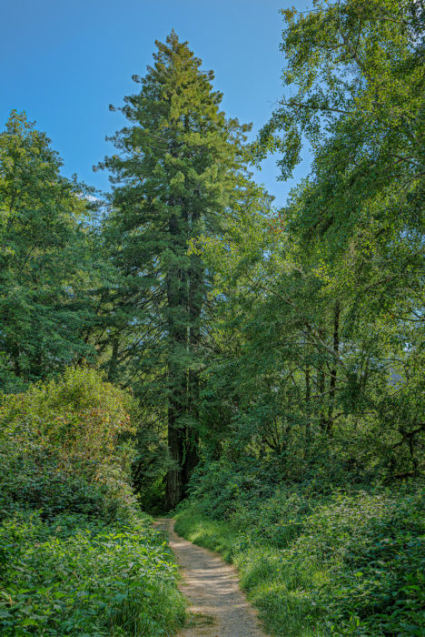
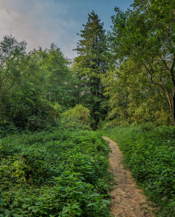
“OK”, I said. “There still has to be other clues as to where the corral was located.” However, I just had to find out if those trees were still around.

All of a sudden, more info and ideas came pouring in. Karin Grantham from Redwood National Park provided an early aerial view of the homesteads. Geologist Vicki Ozaki told me there was something going on around Hayes Creek—she had noticed years ago daffodils growing there every spring. Archaeologist Michael Peterson, ranger Jim Wheeler, volunteer Ted Humphry, and plant ecologist Stassia Samuels all responded to my emails and pitched in with their thoughts (thank you!). Then, I gave another ’67 photo of mine, taken a bit later and closer to the corral, a detailed look.
A graphic of a black-and-white photo of a clearing in a forest, with a backpacker on the left, and red arrows pointing to a corral fence, a creek channel, hardwoods, and three redwood trees.
Photo by Dave Van de Mark
I’ve cropped and labeled this one (removing all but one backpacker) and it shows the corral better. But the most important aspect is that it reveals a significant deep depression (creek channel?) in front of the corral fencing more clearly. I decided to label that Hayes Creek, based on all the other input I was getting. Not proven yet :)
It was decided to launch an “expedition” to Hayes Creek ASAP. Ted Humphry took on the job of contacting everyone, and Aug 27, 2020 was set—again, exactly 53 years after my black-and-white photographs were taken. How cool is that?!
Before 9am, I was ambling very slowly up the trail, doing the only thing I know a little about—making photographs. Soon, Ted, Vicki, Jim, and Michael (on crutches due to recent surgery) caught up with me. We soon crossed Hayes Creek and…
A trail through a forest of redwoods and hardwoods.
Photo by Dave Van de Mark

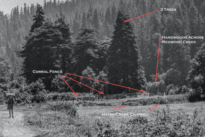
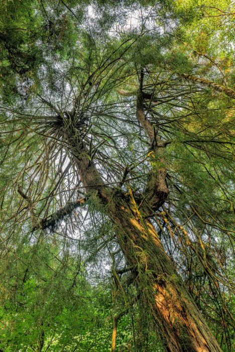
…Those 3 trees again, now viewed further away and showing more surroundings.

A couple things may not be evident that need explaining. The dirt access road used by homesteaders, loggers, and the backpackers, went off to the left as seen on the previous black-and-white photo, clearly crossing Hayes Creek upstream from the corral.
The present park trail, it appears, abandons the old road alignment and passes through where the corral once existed and leads you to the base of the three trees.
So, as best as we could ascertain, it seemed clear that the area behind the fence would be the area seen in the foreground of the previous photo! Plus much more land to the left of that photo. No other redwoods can be seen from my photo position because hardwoods have matured in those 53 years. We walked a little further and there they were—the “grove” of redwoods seen in the black-and-white photos!
Four people on a trail standing in the middle of redwood trees
The expedition crew. Photo by Dave Van de Mark.
After joining the four in what should now be known as the“Corral Grove,” we looked up and before us stood the last piece evidence needed to prove (for me, anyway) that we had found the old corral location with decent certainty: the “flat-top” tree! We all felt that was the icing on the cake :)
Low-angle shot looking up at a redwood tree with gnarly branches.
The flat-topped tree, 53 years later. Photo by Dave Van de Mark.

About the author

Dave Van de Mark is a photographer who has been photographing the lands around Redwood National and State Parks for more than 50 years.

bear reading the blog
Get the latest redwood updates in your inbox

4 Responses to “OK, where’s the corral?”

  1. Allan Erickson

    I’ll bet Jim (Wheeler) was into this. I’ve known him since college and he’s a great – and VERY smart – young man.

    Reply
  2. DARRYL WHITE

    Good story and sounds like a fun expedition, something I would enjoy. Thanks.

    Reply
  3. Susan Schuessler

    It is so wonderful to see that Dave is still doing what he loves. Thank you Dave for such a fun and enlightening story!!!

    Reply
  4. Catherine M Johnson

    I love this so much! You gotta love redwoods to care this much. Kindred spirits. Thank you for this wonderful recounting and for your beautiful photos.

    Reply

Leave a Reply